We have recently received an enquiry looking for photographs of the Ship Café, Earle Street, Yeovil.
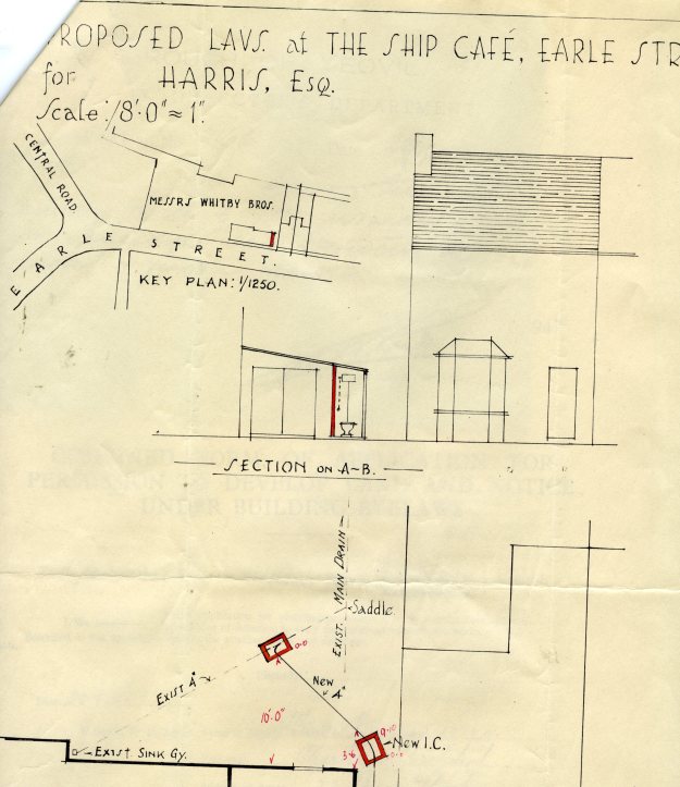
We know this was located in Earle Street in 1953, as we have a planning application to install two new conveniences when Mr Harris was listed as the lessee.
Interestingly, we believe this part of Earle Street was re-developed to become part of Central Road, which now runs from ‘Vincents’ roundabout down to the Bus Station.
The section of Earle Street remains which runs through to meet Reckleford.
Looking at the map on the planning application, this would need to be held upside down in order to be accurate with reality and would seem to indicate that the Ship Café was on the left looking up the road and almost part of what is believed to be the former Whitby Gloving Factory site.
We would be grateful to receive any information or ideally a photograph of the Ship Café to show our enquirer.
01935 462855 or heritage.services@southsomerset.gov.uk
1953 Plan showing the Ship Café, Earle Street, Yeovil